Dreaming of quiet mornings by the water and evening walks with river views? If you are drawn to the Weiser River lifestyle, you are not alone. River-adjacent homes can be special, but they also come with unique checks you do not face in town neighborhoods. In this guide, you will learn the key property types, risks, and due-diligence steps to take before you buy in or around Weiser, Idaho. Let’s dive in.
Weiser River at a glance
The Weiser River runs through Washington County with a character that changes by season. Flows are higher during spring snowmelt and lower in late summer and fall. This seasonal pattern affects small-craft use, fishing conditions, and how stable the riverbank may be in a high-water year.
Some parcels sit inside Weiser city limits, while others fall in unincorporated county areas. That difference matters for utilities, permits, and taxes. You will want to confirm which jurisdiction applies to any parcel you consider and whether multiple agencies have authority over certain river-related work.
Common property types
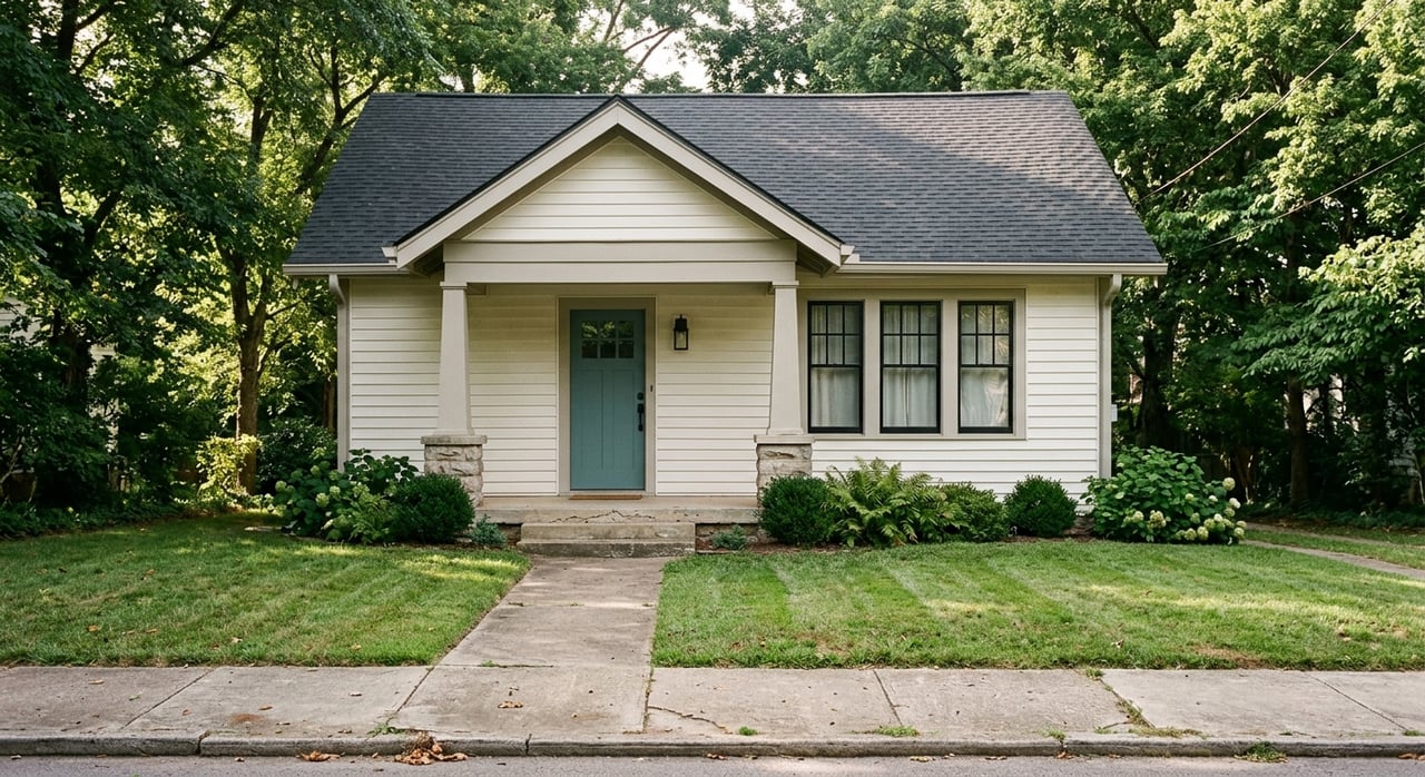
In-city river lots
Inside city limits, you will often find smaller lots with older single-family homes. Some may have access to municipal sewer and water, but availability varies by address. Expansion potential can be limited by lot size and setbacks.
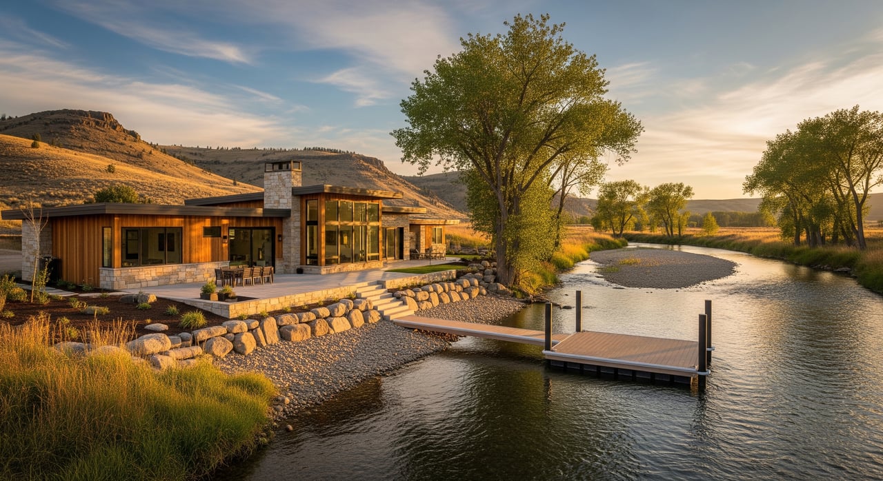
Rural riverfront parcels
Outside town, parcels are usually larger and may include single-family homes, manufactured or modular homes, barns, and agricultural uses. These properties commonly rely on private wells and septic systems and may have private road access.
Recreational cabins and seasonal dwellings
You may see smaller structures designed for occasional or seasonal use. If year-round living is your goal, check utility capacity, winter access, and any use restrictions.
Agricultural and ranch holdings
Larger ranch or farm properties sometimes include riparian frontage for grazing, irrigation access, or conservation. Water-rights details and irrigation infrastructure are critical to review.
Lot layouts and access
Rivers shape parcels over time. Expect irregular boundaries and unique access situations.
- Narrow riparian strips can limit building footprints and require careful siting.
- Flag lots or landlocked parcels may depend on a recorded access strip. Confirm that access is legal and recorded.
- Shared or recorded easements might govern roads, boat launches, or trails. Review the scope and any maintenance duties.
- Public access corridors can exist along some waterways depending on state rules. Verify public access and navigability questions with the proper agencies before you rely on them.
What to verify before you buy
Jurisdiction and zoning
Find out if the parcel lies inside Weiser city limits or in unincorporated Washington County. Zoning rules, floodplain ordinances, and available utilities can differ. Contact city or county planning to confirm which codes apply.
Water rights and irrigation
In Idaho, land ownership does not automatically include the right to divert or use river water. Water rights are separate from the land title and follow prior-appropriation law. Check the Idaho Department of Water Resources records to see if the property has domestic or irrigation rights, and note priority dates and permitted uses. Also look for headgates, ditches, or irrigation district assessments.
Flood risk and insurance
Ask whether the property lies in a FEMA Special Flood Hazard Area. If a structure is in a mapped flood zone and you use a mortgage, flood insurance may be required. Many lenders will request an elevation certificate to help set insurance needs. Request seller disclosures and local records for past flood events or seasonal overflows.
Bank stability and erosion
Riverbanks can shift over time. Erosion can threaten buildings, driveways, wells, and septic systems. A healthy riparian buffer often helps stabilize banks and may be required for certain projects. If you see signs of slumping or undercutting, consider a hydrologist or engineer to assess risk and options.
Permits and environmental rules
Shoreline work such as riprap, bank stabilization, docks, or in-stream work can require permits from multiple agencies. Depending on the project, you may need approvals under the Clean Water Act or state stream-alteration permits. Seasonal restrictions can apply if protected species or habitat are present. Always confirm permitting pathways before planning any bank or in-water work.
Utilities, wells, and septic
Rural properties often rely on private wells and septic systems. Ask for well logs, depth, yield, pump details, and water-quality tests. For septic, request permits, installation records, and recent inspection reports. If the property is near the river, make sure the drain field is properly sited and protected. Inside city limits, verify whether municipal sewer and water are available and what it takes to connect.
Easements and road maintenance
Access may rely on private roads or shared driveways. Confirm recorded easements, who maintains the road, and how costs are shared. Look for utility and irrigation easements as well, since these can affect where you can build or fence.
Title, covenants, and restrictions
Older river parcels sometimes have unusual exceptions or past splits that need a careful title review. Ask about deed restrictions, homeowners’ association rules, or conservation easements that govern tree removal, bank work, or building location. A clear understanding up front helps you plan improvements with confidence.
Soil, geology, and foundation
Riparian soils can be silty or seasonally saturated. If you plan new construction near the bank, a geotechnical review can help you choose the right foundation. In some areas, you may need special engineering, elevated floor systems, or wider setbacks to manage slope and drainage.
Smart offer strategy
River properties reward a deliberate approach. Build targeted contingencies into your offer so you can verify the essentials without overpaying or taking on hidden risk. Common protections include:
- Survey and boundary verification, especially if access or riverbank movement is a question.
- Septic inspection and soil testing, plus well inspection and water-quality results.
- Floodplain determination and, if needed, an elevation certificate and insurance quote.
- Erosion and bank-stability review if structures are near the bank.
- Water-rights confirmation and any irrigation-district obligations.
- Title review focused on easements, access agreements, and restrictions.
A local Weiser agent can coordinate specialists and schedule inspections on a tight timeline.
Buyer checklist
Use this list to keep your review on track.
Documents to request
- Survey or plat map with boundaries, easements, and improvements.
- Preliminary title report, deed, recorded easements, and covenants.
- FEMA flood map determination and any elevation certificate.
- Well log, pump records, and recent water-quality test results.
- Septic permit, install records, and recent inspection results.
- Water-rights records with priority dates and permitted uses.
- Flood-history disclosures and any local flood documentation.
- Permits and approvals for any past shoreline or bank work.
- Photos of the riverbank and nearby conditions upstream and downstream.
Inspections and specialists
- Licensed surveyor for boundary or access confirmation.
- Septic inspection and, if planning changes, a soil perc test.
- Well inspection and lab testing for bacteria and nitrates.
- Structural inspection for existing homes and outbuildings.
- Geotechnical or soil report for new construction near the bank.
- Hydrologist or engineer for erosion risks or stabilization design.
- Title insurance and legal review for complex easements or water-right issues.
Questions to ask the seller or listing agent
- Is the parcel in city limits or unincorporated county, and which utilities are available?
- What water rights, if any, are attached to the property, and what are the priority dates?
- Has the property ever flooded or experienced seasonal overflow? Are there records?
- What easements exist, and who maintains private roads or shared access?
- Have any bank or shoreline modifications been done, and were permits obtained?
- Where are the well and septic systems located, and are there recent service records?
- Are there covenants, conservation easements, or restrictions that limit development or tree removal?
Who to call for verification
- State and federal: Idaho Department of Water Resources for water rights and well records; Idaho Department of Environmental Quality for water quality; Idaho Department of Fish and Game for wildlife considerations; Idaho Department of Lands, if applicable; U.S. Army Corps of Engineers for in-stream work; FEMA for flood maps; USDA Natural Resources Conservation Service for soils; U.S. Fish & Wildlife Service for federal species questions.
- Local offices: Washington County Recorder and Assessor for deeds and parcels; Washington County Planning and Zoning or Weiser City Planning for zoning, building permits, and floodplain rules; local conservation or watershed groups for bank-stabilization guidance.
- Professionals: Licensed land surveyor; title company and real estate attorney; licensed septic inspector and well driller; civil engineer or hydrologist; local contractor experienced in riparian work and permitting.
Living along the river
Life on the Weiser River has a rhythm. Spring can bring higher, faster water and changing bank conditions. Late summer and fall can mean lower flows and quieter recreation. If you plan for these cycles and keep a healthy buffer along the bank, you can protect your home and enjoy the setting.
As you explore properties, focus on two things: your day-to-day use and long-term stewardship. You can set up for fishing, paddling, or peaceful views, while also caring for the shoreline and understanding the permits you might need for any work. With the right checks, you can move forward with confidence.
Ready to walk a parcel and map out a smart plan? Connect with the local team at Two Rivers Real Estate Company LLC to schedule a consult and see what is available now.
FAQs
What should I know about Idaho water rights on the Weiser River?
- In Idaho, water rights are separate from land ownership. Confirm any domestic or irrigation rights, including priority dates and approved uses, before you rely on them.
How do I check flood risk for a Weiser River home?
- Ask for a FEMA flood map determination and any elevation certificate, then get flood-insurance quotes. Review seller flood history and consider an erosion assessment.
What septic and well steps are essential on rural river parcels?
- Request well logs and water-quality tests, plus septic permits and a recent inspection. Verify that the drain field and well are properly sited for riparian conditions.
How do easements affect access to riverfront lots near Weiser?
- Many parcels use private roads or shared driveways. Confirm recorded access, who maintains it, and any costs or restrictions tied to easements.
Do I need permits to stabilize a riverbank or add a dock?
- Often yes. Bank stabilization and in-stream work may require approvals from state and federal agencies. Verify permit needs and timelines before planning any project.